Part 1 is here.
Thursday the 26th was Thanksgiving, and Frank spent the morning cooking. I ventured out alone; I get less comfortable going solo every year. Because I’m not very good with a GPS, I tend to prefer visiting areas I know well or restricting myself to places where I can rely on my sense of direction, compass, and iPhone map to get out safely.
For these reasons, I returned to the area where we had concentrations of scaling in 2012 and 2013, and where I recorded calls and had a possible sighting in 2013. There has been a significant increase in human and porcine activity in this area; both people and hogs are having an impact on the hydrology, and places I know well have changed a lot in less than three years.
I did not see or hear anything of interest – no sign, no calls, no knocks, but this is where access to the bottom is easy. The damage is being done on the periphery, and the core is much harder to reach. (Much of the activity in 2012 and 2013 was remarkably close to the edge.) Most of our attention has been focused elsewhere since 2014, so there’s no telling what might be going on in less accessible parts of this sector.
November 27th was something of a banner day but also a very difficult one. Frank, Brian, and I got to an area that hadn’t been visited before, although we did cross a track that Frank and Bob Ford made back in October. Access to the bottom involves hiking approximately 2 miles, .5 of which is on an old logging road. The rest is cross country and is not easy going, since there are dense pine plantations to traverse. Beyond the pines, there are several sloughs to cross or circumvent, but once you get there, it’s an incredibly beautiful area.


As Mark says, the area is quite beautiful once one has made it into the core. The difficulty in reaching the “core” cannot be overstated. The portion of the hike on the old logging road (actually more of an overgrown trail) is not too difficult, but once committed to crossing terrain, it becomes an entirely different story. We have often remarked on this, but I believe a little more explanation of exactly why the going is so tough will help the reader to better grasp the challenges.
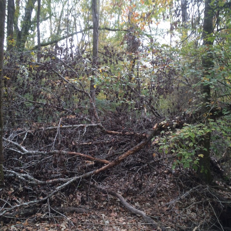
Once the trail is left behind, one has to decide whether to blaze a straight line, or allow the terrain to dictate the direction of travel and work in a general direction. We generally just plow through thicker, younger pines in a straight line. The buffer habitat, which runs to middle aged pine with some oak and hickory scattered about is not too bad for either choice – at first glance. Once into these areas, one finds a lot of blown down timber in various stages of decay, from very recent to several years old. Even on level ground, these blowdowns require going off course, or stepping over. Then there is the occasional blackberry or saw briar patch to contend with.
As one continues to approach the core, the sloughs that Mark mentioned in passing begin to impose obstacles. Many times, to maintain a straight course, we find ourselves crossing the same slough several times. The sloughs are of two types, each presenting a different set of challenges. The first are the tributary sloughs. These are often dry, but are incised into the surrounding terrain, requiring one to find a way into and out of the streambed. The depth of the incision varies from a couple of feet to as much as ten to twelve feet depending on the carrying capacity of the slough, and its proximity to the main stream channel. The second type are the larger cutoff, stillwater sloughs. Once the rains begin in October, these hold water all the time. While only incised a foot or two into the terrain, they can be a couple of feet deep, often just enough to overtop one’s boots. This requires leaving the course line and hunting a place that’s shallow enough to cross – or finding a log to cross on. Waders, except during the wettest, coldest times, are not really practical as they get very hot and uncomfortable on even slightly warm days. Another challenge is the uniformity of the various types of habitat. Without a compass or GPS (I use a very high end Lowrance unit and carry a high quality compass for backup) one can be seduced by the easier walking and just make big circles, not really covering much ground. I’ve lived near, and turkey and deer hunted in this area for much of my life, and a few lucky souls get to spend a night or two in the woods every year.
On this particular day, Friday the 27th, the understory in the portion of the core area we visited was quite thick, unusual in this bottom, where the core areas tend toward an open hardwood gallery forest. The area is just a bit higher in elevation than most of the rest of the core – perfect for native bamboo canebrake. The cane affords a bit of protection for the blackberry briars and other “catchy” vegetation, making traversing even the heart of the bottom in this particular area a difficult proposition. On our way out, we encountered one of the “stillwater” sloughs that I mentioned earlier. Brian and Mark got water in their boots crossing it. I found a downed loblolly that made a pretty good bridge, but the bark was long gone, and the log was unbelievably slippery. I “scooted” across rather than risk a dunking, and strained my wrist in the process. Maybe I should have opted for the wet feet…
At the farthest point from the road, we found a recently downed sweet gum top that had been fairly heavily scaled (more heavily than the similar tree we found on the 24th).


The hanging, shredded bits of cambium on some of the scaled areas appear to be what Edith Kuhn Whitehead said her father considered diagnostic ivorybill sign. This led me to revisit Tanner and look at Plate 8; the images of feeding sign in Tanner are very poorly reproduced, and the originals are not much better. There is a higher quality scan of Plate 8 on the US Fish and Wildlife Service’s website, and after another look, we’re struck by the similarities between that image and a couple of the above details. While Tanner is often opaque about his reasons for selecting images of feeding sign, we suspect Plate 8 was included to illustrate what Mrs. Whitehead described.

We spent over an hour in this location and heard multiple possible kent calls and double knocks. We captured one of the double knocks on Frank’s recorder, but it’s too faint to be analyzable. One of the calls that I heard (but Frank did not) was perhaps the most Singer Tract-like ever to my ears, so much so that I had to ask Frank whether he had done a playback.
On the way out, I spotted some more extensive high branch scaling, apparently on a sweet gum within 25 yards of the downed tree.

Unfortunately, while the location is fairly close to the concentration described on the blog, it’s only reachable as the bird flies. We’d love to put a camera on it, but that’s not possible at this time. And all four cams are deployed in promising locations. We don’t have the time or personnel to handle more than we’ve got.
On Saturday the 28th, we retrieved the card from the camera that’s trained on the downed sweet gum top. It functioned perfectly but produced no hits. We did get some apparent double knocks after a series of ADKs; one was captured on the recorder but again was too faint to be analyzable.
We’d like to address a Facebook comment from a British ornithologist and extinction believer who characterized our inability to obtain something conclusive thus far as “negative evidence”. The fact of the matter is that the negative evidence we’ve obtained relates to Pileated Woodpeckers, not ivorybills.
Pileateds are abundant throughout the area, in the uplands as well as the bottoms. I constantly scan the woods for suggestive scaling. To repeat something I’ve said in a couple of earlier posts, we have seen an abundance the type of work we think is characteristic of ivorybills in our two Louisiana search areas. I have looked at Pileated sign throughout much of that species’ range and have examined countless images of Pileated Woodpecker scaling online. I have not found any examples that match what we take to be ivorybill work. Nor have I ever found any in our search area’s mixed pine-hardwood uplands. In the bottomlands, we’ve found this work scattered throughout the mature forest. We’ve also found clusters of it in several locations. In a couple of places, like the area I visited on Thursday, there have been concentrations of scaling in one or two years and not in others.
This week we got a series of images of a PIWO on both forks of the downed sweet gum top (not retained), where it spent several minutes. It did no scaling. Over the years, we have obtained a few sequences showing the same behavior, including this one. In a single instance, we captured a Pileated scaling a quarter-sized piece of bark, with some difficulty, from our target tree, a freshly dead oak. It did nothing more, and approximately six months elapsed between incidents of major scaling. (The second round happened after we’d removed the trail cam.)
There’s no way to prove a negative, but the evidence we’ve obtained points to something other than Pileated Woodpeckers as the source for the following reasons:
- The scaling is unlike work done by Pileateds elsewhere.
- We have documented Pileateds on heavily scaled trees but have not documented them removing anything but a single small piece of bark.
- The distribution of the scaling in our search area points to something other than Pileated Woodpeckers as the source, since Pileateds are abundant throughout, and the scaling is found only in mature bottomland hardwood areas, not in mixed and hardwood dominant uplands.
- The fact that we’ve found concentrations of scaling in certain areas in one year and not in others suggests that whatever is doing the bulk of it has a home range that’s considerably larger than that of the Pileated Woodpecker.
- Anatomically, bark scaling is an inefficient foraging strategy for Pileated Woodpeckers. It seems unlikely that Pileated Woodpeckers would do so much foraging in such an inefficient manner when other food sources, including insects in rotten wood and (at this time of year) mast, are abundant.
We hope the current camera deployments will solve this mystery of what’s doing this type of work . . . within the next few weeks.
Quite a deservedly dramatic ending there gentlemen. That would be amazing to have great images of an IBWO after all these years! Mark, is there a good time to call this week? I have a number of questions, again. And I want to share what I am thinking as well.
Well, we can’t promise anything and don’t want to raise expectations excessively; had we not had camera problems, we would have had the answer a couple of weeks ago. We’re hoping that the source of the scaling will prove to be IBWO, as we believe it to be. In terms of images, good enough would be great.
Frank, you mention that you use a high quality compass as backup. I am going to have to invest in a new compass soon, as mine was apparently not constructed to withstand the demands I have placed on it. Do you have a recommendation?
Really, Chris, pretty much any compass in the $25+ range is good. Check it a few times a year to be certain the needle hasn’t “turned”. The flat base is my preference, rather than the folding or flip style. I can’t stress enough how important a good GPS is – not just for nsvigation, but for getting back to something you want to find again.
Thanks!